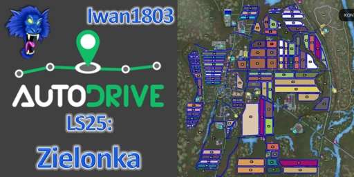
AutoDrive route network for the map “Zielonka” (English version inside)
The route network is based on my AD course from the LS22. Only the lime station, the cement factory and the BGA were added.
It was tested with various vehicles (e.g. Fendt 1050 with Strautmann Aperion 3401 and Claas Lexion 8900 with Convio Flex 1380 on Nardi N60-45), but it can of course happen that it doesn’t fit 100% in one place or another.
Please let me know about it so that I can correct it or correct it for yourself.
The following was entered:
– all roads and field paths as well as all associated intersections and junctions including right of way rules
– all 3 farms including silo & chicken coop
– all productions as well as purchase & sales points
– all fields including fishing lines
– vehicle dealer, petrol station and a water extraction point
Duration:
– approx. 45 hours for entering
– approx. 25 hours for extensive testing, optimizing and correcting
– approx. 15 hours for additions and retesting
Note:
– the appropriate vehicle settings have already been saved as standard in the config. You can transfer them to existing ones using the “Restore” button.
Otherwise: activate folder, collision height above ground to 1.75m, collision detection to “Yes”, max. silo distance to 25m, field exit nearest
Abbreviations for the target points:
Anl. = delivery, unloading
Ent. = removal, collection
Have fun with this course!


